
Houston’s unending summerlike weather may finally get a break this weekend.
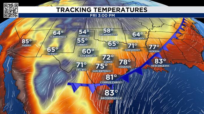
A cold front is expected to approach SE Texas late Friday, potentially bringing our first real fall feel by Saturday.

The change starts thousands of feet above the ground, we generally see big changes in our weather patterns develop in the upper levels of the atmosphere first.
An area of low pressure is strengthening in the upper atmosphere and set to move southeast from the western United States. That disturbance will help organize a low-pressure system over the central Plains, while a strong area of high pressure helps push cooler air southward behind the front.

Think of the front as the dividing line between two different air masses. In front of it, Houston stays summerlike, warm and humid. Behind it, winds shift and drier air moves into the region.
That drop in humidity can make a big difference in how the temperatures feels, dry and sunny vs humid and sunny.
Saturday could bring highs in the 70s for the first time in a LONG time, along with lower humidity and plenty of sunshine. Some locations could see morning temperatures dip into the 50s, especially on Sunday morning.

If the forecast holds, the weekend could offer one of the more noticeable breaks from Houston’s summerlike weather in recent months.

The front’s timing and strength will be important to watch. For now, the biggest expected changes are cooler temperatures, drier air and a more comfortable feel across Southeast Texas.


